(Phnom Penh): On Friday (Feb. 13), in the digital age, accessing satellite data has become easier than ever, but interpreting that data accurately remains a significant challenge.
NASA’s Fire Information for Resource Management System (FIRMS) is a powerful tool, yet it is frequently misunderstood by the public as a "real-time fire map."
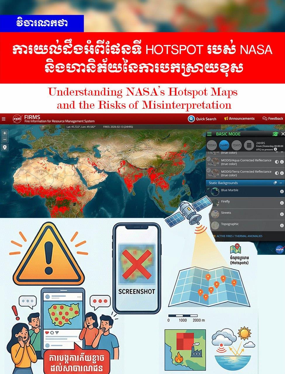
1-What is a Hotspot?
Technically, satellites do not take photos of "flames." Instead, the NASA system detects Thermal Anomalies. This is a measurement of infrared radiation emitted from the Earth's surface at unusually high levels. The sources of these thermal signatures can include:
-Grassland fires or small waste burning.
-Seasonal agricultural burning.
-Industrial activities or factories (e.g., thermal chimneys/flares).
-Wildfires.
-Large rock formations that absorb intense solar heat (in some cases).
2-Technical Limitations
Hotspot data is not irrefutable evidence of a wildfire due to several factors:
-Spatial Uncertainty: A single red dot on the map represents an area of approximately 375m x 375m (for the VIIRS satellite). Therefore, even a small fire will appear as a large dot covering that entire area.
-Weather Obstacles: Thick cloud cover or heavy smoke can prevent satellites from detecting heat signatures. Conversely, sunlight reflecting off water or glass can sometimes trigger a "False Positive," where the system mistakenly identifies it as heat.
3-The Risks of Sharing "Screenshots"
The most common issue occurs when users take a screenshot of a hotspot map and share it on social media without explanation. This practice poses several risks:
-Loss of Temporal Context: Screenshots do not show exactly when the heat was detected (sometimes it is old data from a fire that has already been extinguished).
-Confidence Level: The NASA system always specifies a "Confidence Level" (Low, Nominal, or High), but screenshots often overlook this critical detail.
-Generating Fear: Seeing a map saturated with red dots can cause public panic and lead to the misconception that a massive wildfire disaster is occurring.
Conclusion
NASA’s data is a valuable scientific tool for monitoring and prevention, but it is not "legal evidence of a crime" or a "literal image" of fire size. This information should be presented by experts or accompanied by clear technical explanations to avoid misinterpretations that lead to social confusion.
=FRESH NEWS