(Phnom Penh): Combining data from both methods, satellite and ground-based PM2.5 data, provides a clearer picture of air quality. PM2.5 refers to fine particulate matter in the air with a diameter smaller than 2.5 micrometers (approximately 30 times smaller than a human hair). Due to their microscopic size, these particles can penetrate deep into the lungs and enter the bloodstream, posing significant risks to human health.
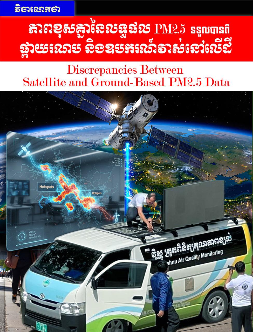
To monitor air pollution and protect public health, scientists use two primary methods to measure PM2.5: ground-based monitoring and satellite observation. However, results from these two methods often differ because they measure air quality in fundamentally different ways.
Ground-Based Monitoring: Direct Measurement
Ground-based stations measure PM2.5 directly from the air at surface level the zone where humans breathe. These devices are mostly installed in cities, near roadways, or in industrial areas. Because they sample the air directly, they provide high accuracy for specific locations. They can also monitor continuously throughout the day, capturing fluctuations in pollution levels. However, installing and maintaining these stations is expensive, meaning they are not available everywhere, particularly in rural or remote areas.
Satellite Monitoring: Aerial Estimation
Satellites do not measure PM2.5 directly. Instead, they observe how dust and particles in the atmosphere known as Aerosol Optical Depth (AOD) reflect or absorb sunlight (i.e., how much sunlight is blocked or scattered by particles in the air). Scientists then use complex mathematical formulas to estimate PM2.5 levels at the surface. The main advantage of satellites is their ability to cover vast regions, helping to monitor pollution in areas where ground stations are absent. Nevertheless, because they do not measure at the surface directly, the results can be less precise.
Reasons for the Discrepancy in PM2.5 Results
Several key factors cause the difference between satellite and ground-based data:
(a) Location: Ground sensors reflect pollution levels in a very localized area, whereas satellites provide an average value over a large region. Consequently, a satellite might miss "hotspots" of high pollution, such as those near a major highway or a specific factory.
(b) Timing: Ground stations monitor 24/7, while satellites typically pass over a specific area only once or twice a day. Furthermore, satellites require clear, cloudless weather to function; thus, they may miss short-term pollution events like rush-hour traffic jams or sudden fire smoke.
(c) Weather Conditions: Weather can skew satellite results. For example, high humidity or cloud cover can make pollution appear more intense than it actually is, whereas ground-based sensors are much less affected by these atmospheric conditions.
Conclusion
Despite the differences in their results, both satellite and ground-based measurements are essential. Ground-based sensors provide precise data for specific locations, while satellites offer a broader understanding of air pollution across vast territories. Using data from both methods together provides a more comprehensive and accurate picture of air quality, ultimately leading to better protection of public health.
The views expressed in this article are those of the author.
=FRESH NEWS