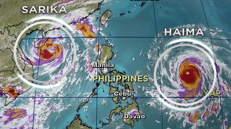
MANILA, Oct. 19 (Xinhua) -- Typhoon Haima is continuing to gain strength as it approaches the Philippines' main island of Luzon, prompting disaster officials to place Metro Manila and many areas in northern Luzon under high alert.
As of Wednesday morning, the typhoon was spotted 450 km east of Casiguran, Aurora province, the Philippine State Weather Bureau said.
The bureau said in its bulletin the typhoon has a maximum winds of up to 210 km per hour and gustiness of up to 260 km per hour. It predicted the typhoon to move west northwest at 26 km per hour.
"It is expected to intensify further before making landfall," the bureau said, adding the typhoon is expected to hit Cagayan area early Thursday morning before crossing the provinces of Apayao and Ilocos Norte.
Haima is predicted to dump heavy rains that may cause flooding in northern Luzon provinces.
"Estimated rainfall amount is from moderate to heavy within the 700 km diameter of the typhoon," the bureau said.
"Sea travel is risky over the eastern seaboard of Southern Luzon and the northern and eastern seaboards of Samar," the bureau warned.
Haima is expected to leave the Philippines early Friday and veer towards China coast by evening, the bureau predicted.