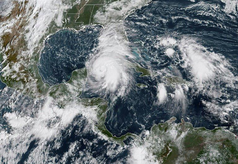
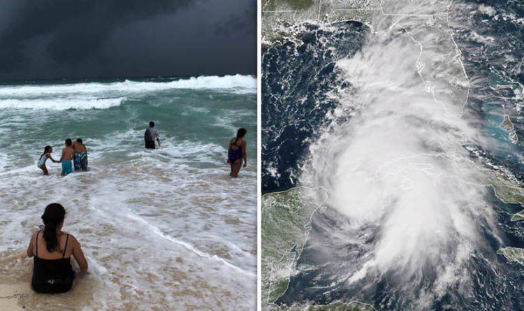
HAVANA, Oct. 8 (Xinhua) -- Hurricane Michael battered the western tip of Cuba on Monday with strong winds and heavy rains as it whipped through the Yucatan Channel on its way to the Gulf of Mexico, where it could become a major storm in days.
At 3 p.m. local time (1900 GMT), the eye of the hurricane passed over San Antonio Cape, the westernmost point of the Caribbean island, as heavy rains and hurricane-force winds lashed the province of Pinar del Rio and the Isle of Youth.
The nation's Civil Defense agency issued a hurricane warning for those two territories and maintained a hurricane watch for the western provinces of Artemisa, Mayabeque and the capital Havana.
The storm became a category 1 hurricane on the Saffir-Simpson scale on Monday at noon with maximum sustained winds of 120 km/h, and continues to move north at 11 km/h.
According to the island's chief meteorologist, Jose Rubiera, Michael is expected to continue impacting this region throughout the rest of the day as well as Tuesday morning before moving on to the Gulf of Mexico.
Rubiera reported up to 10 cm of rain in the last four hours in different areas of Pinar del Rio, and high waves of 5-6 meters along the country's southern coast.
Severe flooding will affect the south coast of the Isle of Youth and Pinar del Rio in the coming hours, while moderate flash floods could take place in Artemisa and Mayabeque, he said.
"Hurricane-force winds extend outward up to 45 km from the center (of the storm) and tropical storm-force winds extend outward up to 280 km, taking into consideration the large size of the system," said Rubiera.
The hurricane's trajectory indicates it will strengthen over the Gulf of Mexico on Tuesday and Wednesday morning before making landfall in the U.S. state of Florida as a potential category 3 storm.